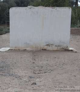
Oase de Ouijjane (2007) Oase de Ouijjane (Morocco) - 2307 - 2007-04-16. [Practice/process]
![[img]](http://dap.ub.rug.nl/11229/1.hassmallThumbnailVersion/2307.jpg)
|
Image
2307.jpg - Submitted Version Download (494kB) | Preview |
| Item Type: | Practice/process |
|---|---|
| Documents: |
Image
2307.jpg - Submitted Version Other (Thumbnails conversion from image to thumbnail_lightbox) lightbox.jpg Other (Thumbnails conversion from image to thumbnail_preview) preview.jpg Other (Thumbnails conversion from image to thumbnail_medium) medium.jpg Other (Thumbnails conversion from image to thumbnail_small) small.jpg |
| Title: | Oase de Ouijjane (Morocco) - 2307 - 2007-04-16 |
| Photo number: | 2307 |
| Photo authenticity: pose: | Unknown |
| Photo authenticity: activity: | Unknown |
| Photo authenticity: setting: | Unknown |
| Date: | 16 April 2007 |
| Date: accuracy: | Year, month and day are known |
| Location: site name: | Oase de Ouijjane |
| Location: country: | Morocco |
| GPS-north: degrees: | 29 |
| GPS-north: minutes: | 37 |
| GPS-north: seconds: | 47 |
| GPS-east: degrees: | 9 |
| GPS-east: minutes: | 32 |
| GPS-east: seconds: | 15 |
| GPS accuracy: | Accurate |
| Family number: | 0 |
| Genus number: | 0 |
| Process: level 1: | Working the fields |
| Process: level 2: | ["eprint_fieldopt_process_level_2_water_manegement" not defined] |
| Process: level 3: | Irrigation |
| People: gender: | Unknown |
| People: age: | Unknown |
| Environment: level 1: | Village |
| Photographer: | Cappers, R.T.J. |
| Figure: | 145 |
| GPS North WGS84: | +29.62972222 |
| GPS East WGS84: | -9.5375 |
| Caption: | Wall and row of stones used for determining the length of time allotted for irrigation. |
| Depositing User: | Unnamed user with email ub-repos@rug.nl |
| Date Deposited: | 26 Sep 2017 12:37 |
| Last Modified: | 26 Sep 2017 12:37 |
| URI: | http://dap.ub.rug.nl/id/eprint/11229 |
Actions (login required)
 |
View Item |


