
Karacomak (2015) Karacomak (Turkey) - 10543 - 2015-08-14. [Practice/process]
![[img]](http://dap.ub.rug.nl/13020/1/10543.jpg)
|
Image
10543.jpg - Submitted Version Download (1MB) | Preview |

| Item Type: | Practice/process |
|---|---|
| Documents: |
Image
10543.jpg - Submitted Version Other (Thumbnails conversion from image to thumbnail_lightbox) lightbox.jpg Other (Thumbnails conversion from image to thumbnail_preview) preview.jpg Other (Thumbnails conversion from image to thumbnail_medium) medium.jpg Other (Thumbnails conversion from image to thumbnail_small) small.jpg |
| Title: | Karacomak (Turkey) - 10543 - 2015-08-14 |
| Photo number: | 10543 |
| Photo authenticity: pose: | Unknown |
| Photo authenticity: activity: | Unknown |
| Photo authenticity: setting: | Authentic |
| Date: | 14 August 2015 |
| Date: accuracy: | Year, month and day are known |
| Location: site name: | Karacomak |
| Location: country: | Turkey |
| GPS-north: degrees: | 41 |
| GPS-north: minutes: | 9 |
| GPS-north: seconds: | 27 |
| GPS-east: degrees: | 33 |
| GPS-east: minutes: | 42 |
| GPS-east: seconds: | 10 |
| GPS accuracy: | Accurate |
| Family number: | 0 |
| Genus number: | 0 |
| Process: level 1: | Fuel/manure processing |
| Process: level 2: | Storage |
| People: gender: | Unknown |
| People: age: | Unknown |
| Object: level 1: | Fuel/manure |
| Object: level 2: | Dung |
| Environment: level 1: | House |
| Environment: level 2: | Courtyard |
| Photographer: | Cappers, R.T.J. |
| Figure: | 180 |
| GPS North WGS84: | +41.1575 |
| GPS East WGS84: | +33.70277778 |
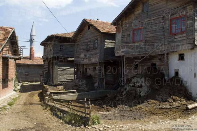
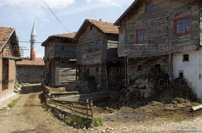
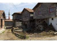
| Caption: | Street view showing the backyards of farmhouses. The ground floor is used for storage and as cow stable. The dung is removed into the backyard through small openings in the wall. This dung is subsequently mixed with straw and used as manure. |
| Depositing User: | Unnamed user with email ub-repos@rug.nl |
| Date Deposited: | 26 Sep 2017 12:47 |
| Last Modified: | 26 Sep 2017 12:47 |
| URI: | http://dap.ub.rug.nl/id/eprint/13020 |
Actions (login required)
 |
View Item |
